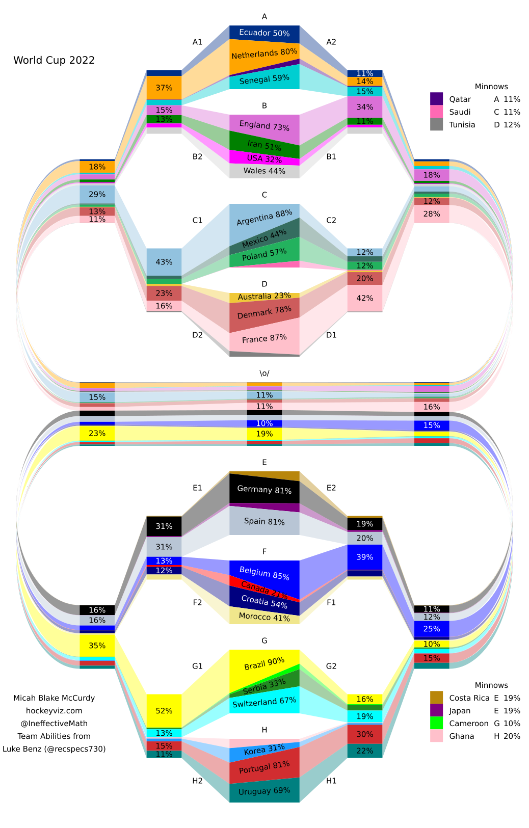
 [OC] 2022 Men's World Cup Chances
Submitted by mbmccurdy t3_yx532l
/f/dataisbeautiful
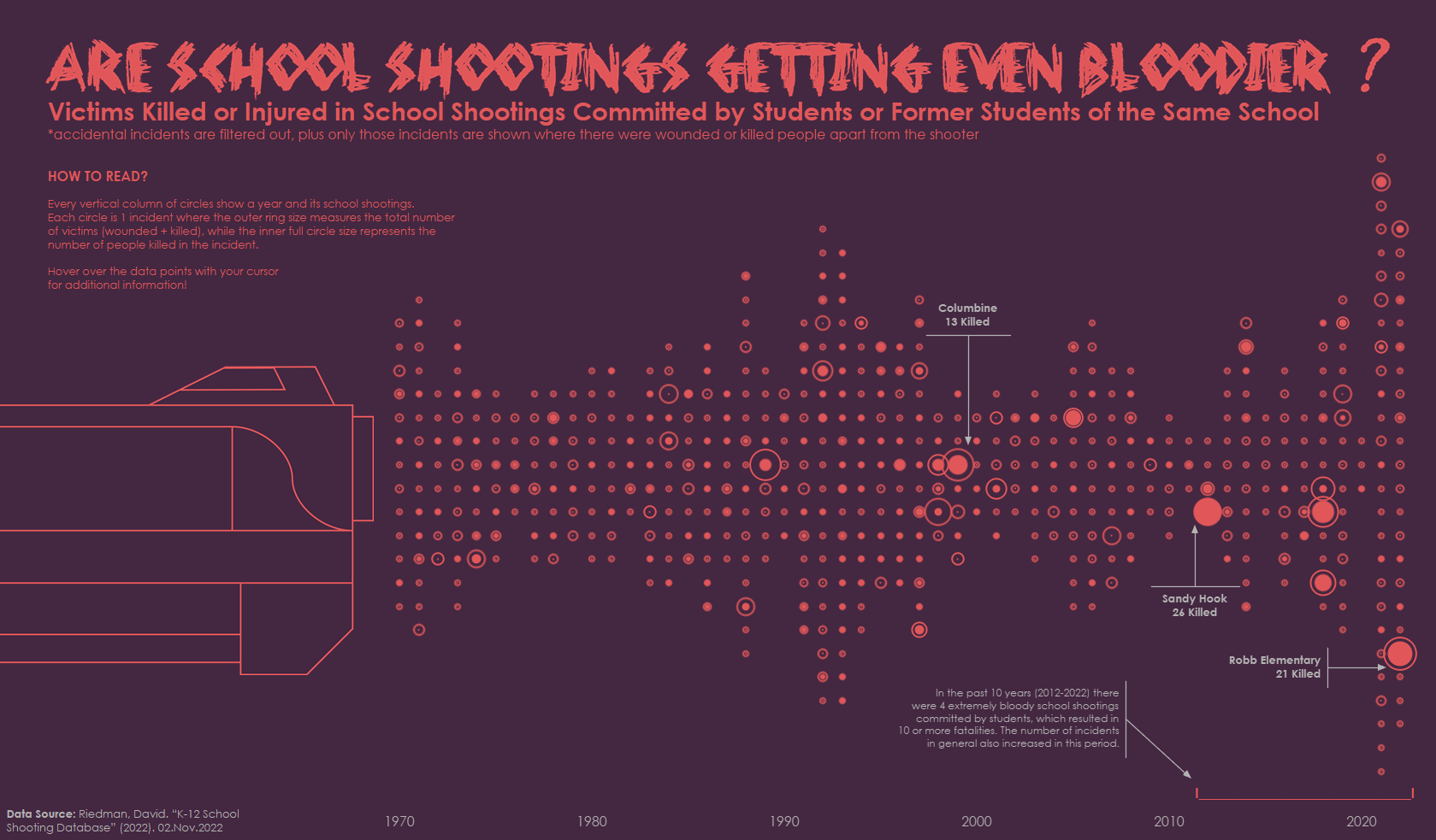 School Shootings in the US 1970-2022 Committed by Students [OC] (interactive version in comment)
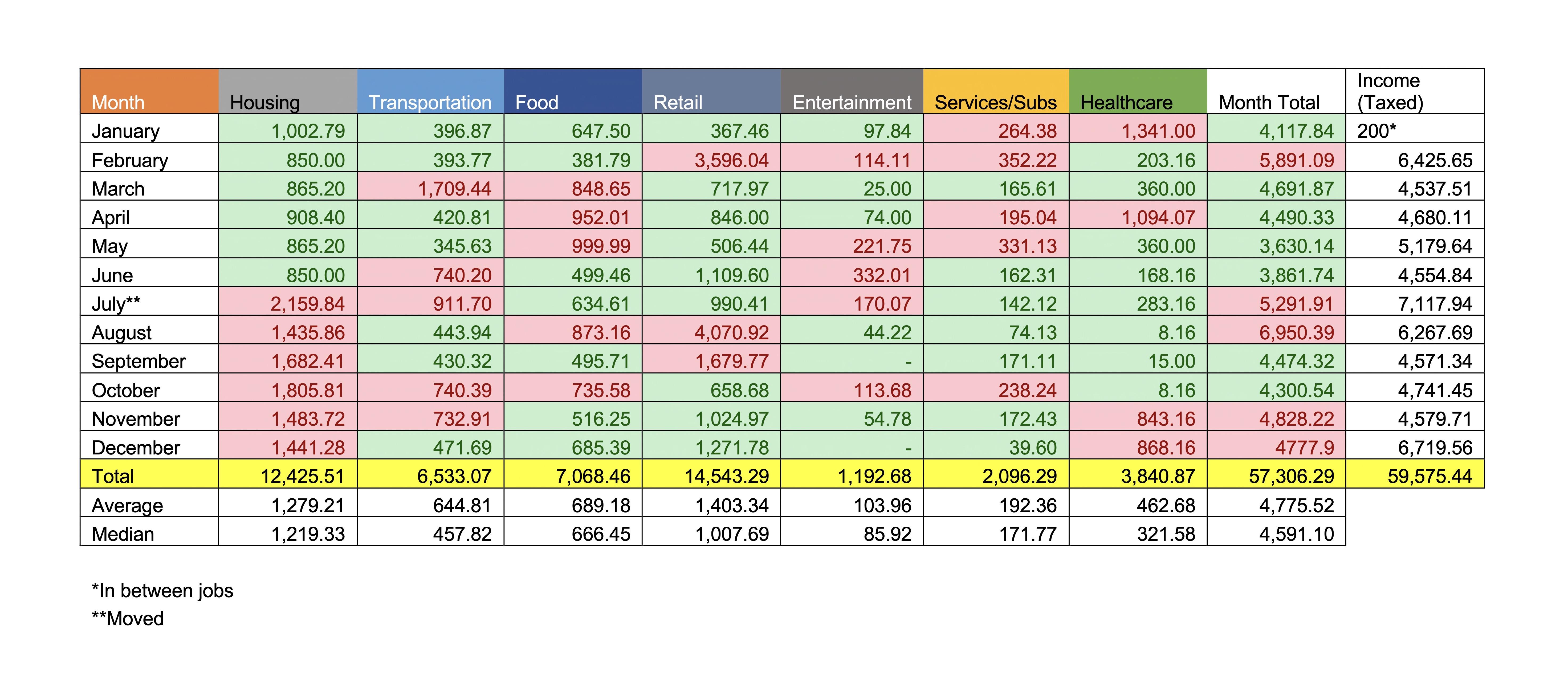 [OC] I tracked my spending for a whole year (2022). Every receipt was tracked in a monthly spreadsheet and I compiled this chart from there. My income shown is post-tax and after investment/saving account contributions. I get paid hourly and for overtime work.
Submitted by ironicsharkhada t3_10bui99
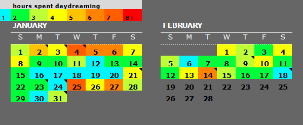 [OC] This year I'm trying to document how my mental illness progresses/regresses to see if there's some sort of pattern
Submitted by plotset t3_11jfswk
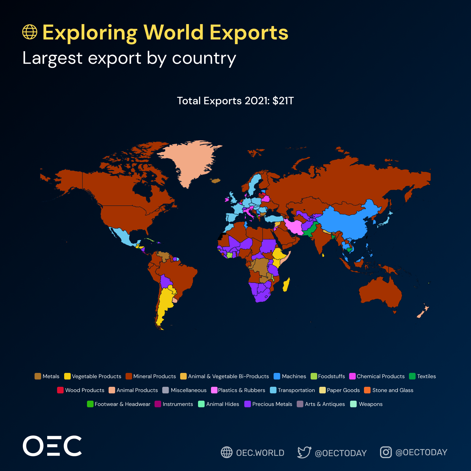 [OC] More than US $21 Trillion were traded in 2021 globally
Submitted by RobinWheeliams t3_127ukry
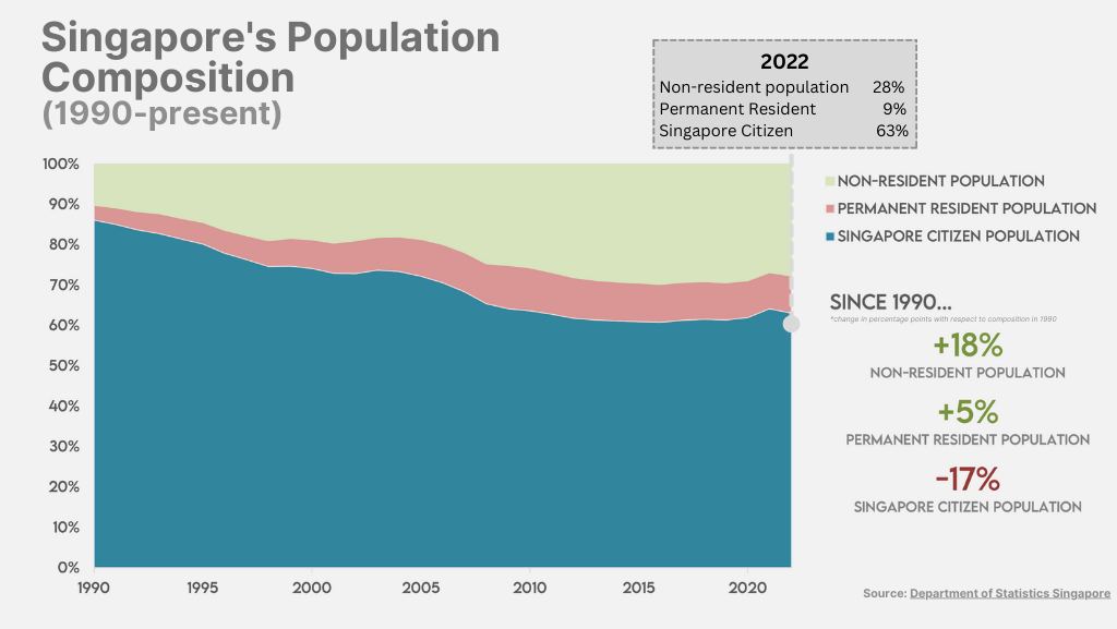 [OC] Singapore's population composition over the years
Submitted by meljap t3_xwvhhr
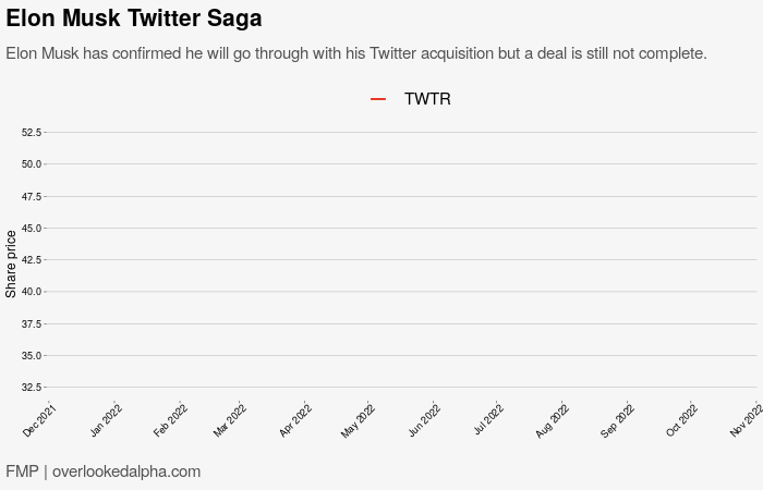 [OC] Elon Musk Twitter Saga (right click chart to turn off loop)
Submitted by OverlookedAlpha t3_y7282u
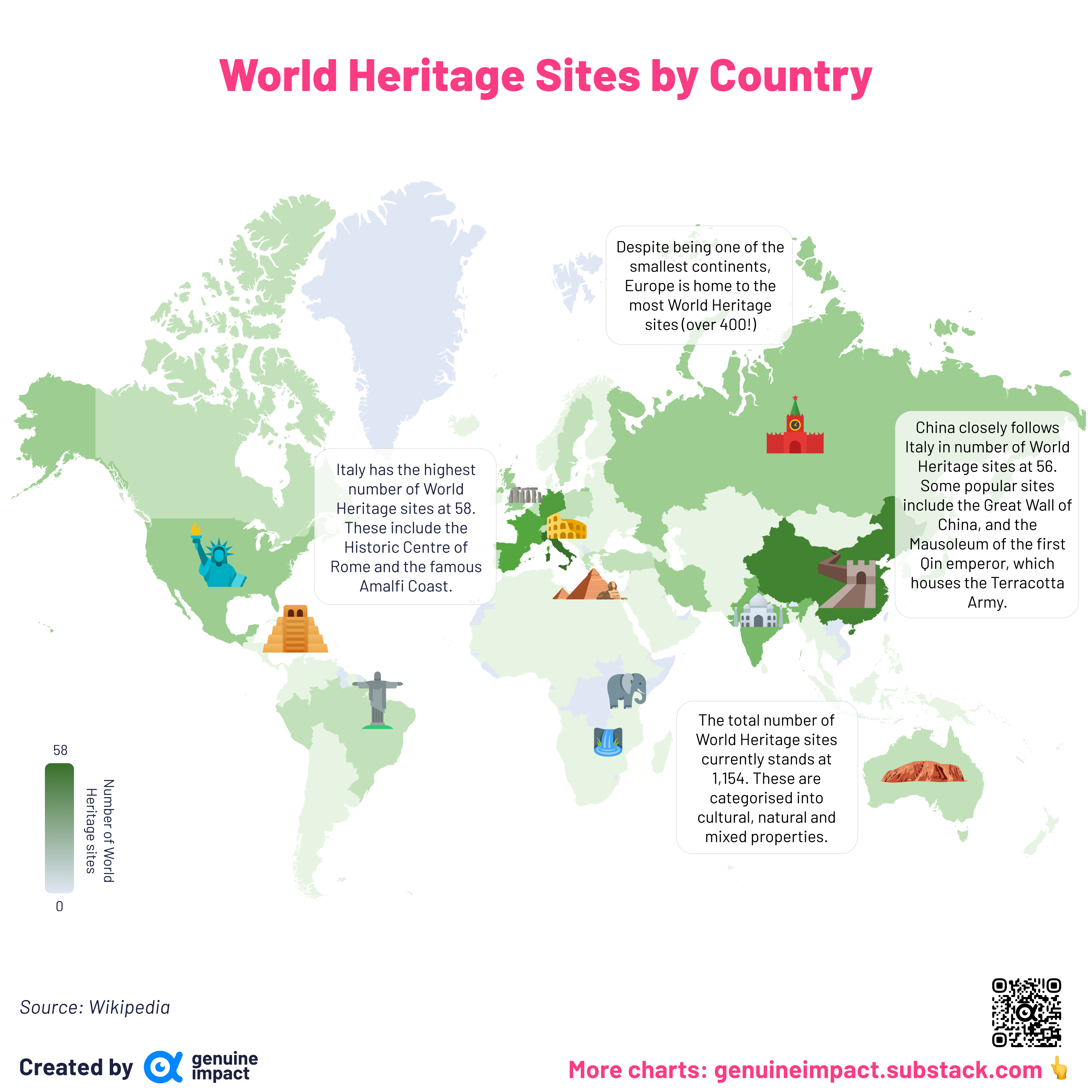 [OC] World Heritage sites by country
Submitted by giteam t3_10ck7x7
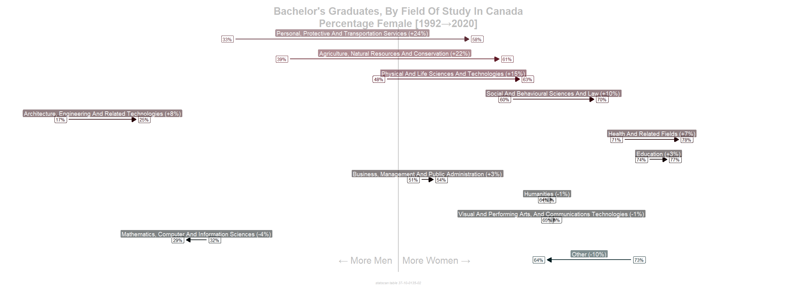 [OC] Fraction Female Batchelor Degree in Canada By Field of Study, 1992 -> 2020
Submitted by hswerdfe_2 t3_10squaa
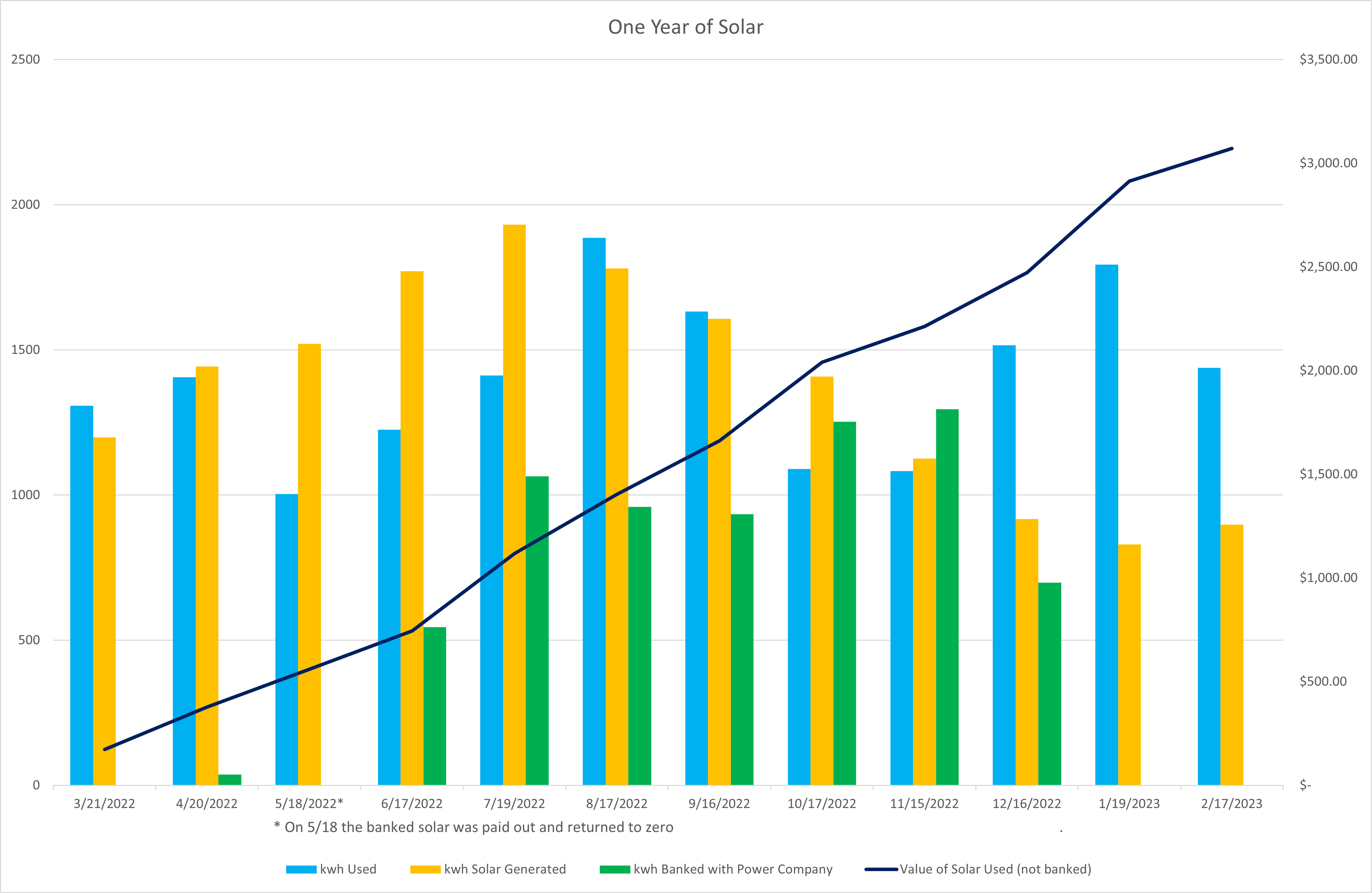 [OC] Value of solar after one year
Submitted by _Glen_ t3_11ddk26
 [OC] Network of top 20 used Pokemons for VGC 2023 Series 2
Submitted by blueboy151 t3_1194z7w
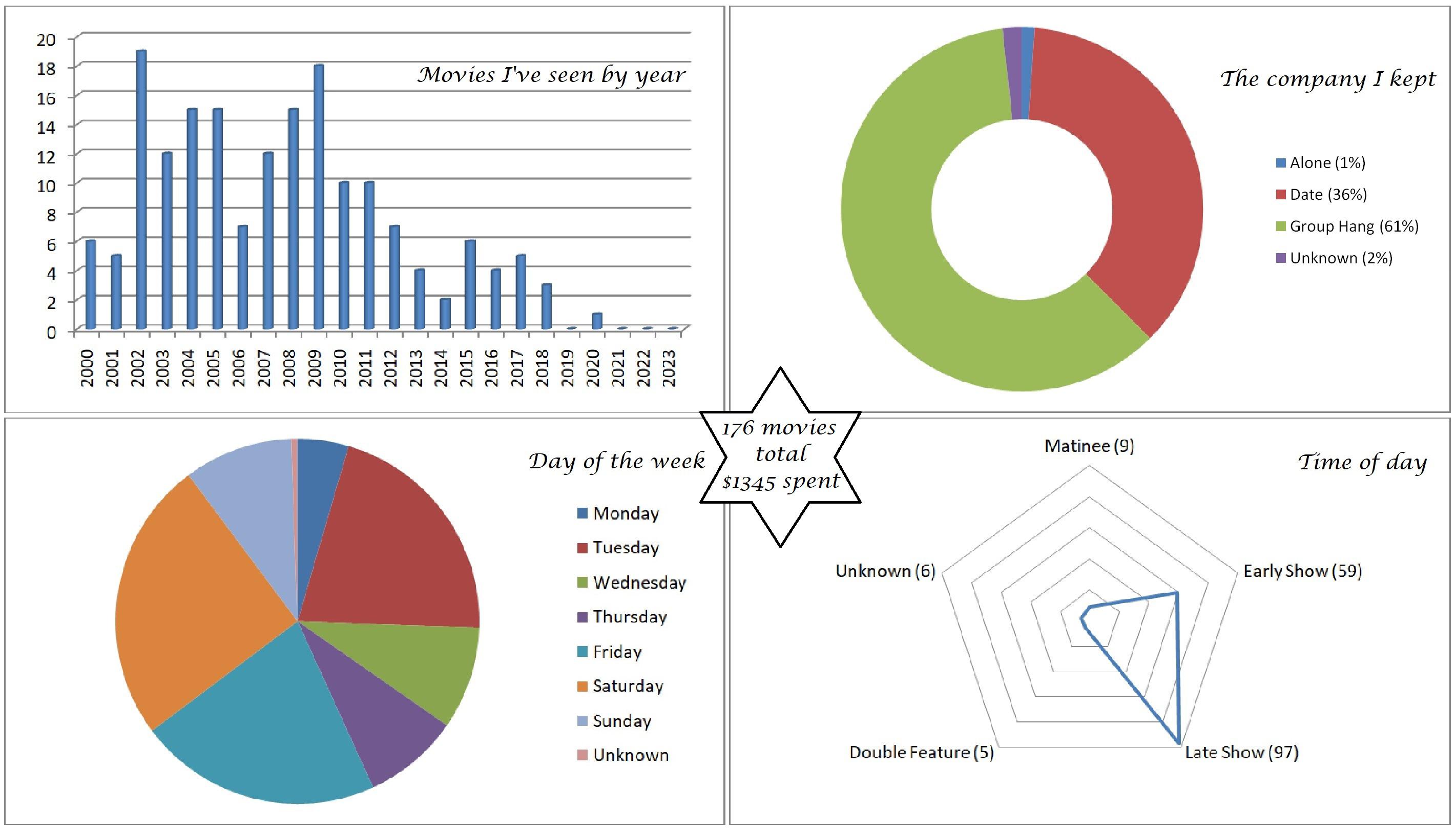 [OC] Analysis of movie ticket stubs collected since 2000
Submitted by HeySquirrelFriends t3_11jxba1
Submitted by corvusmonedula t3_125if9d
Utah Highway LiDAR Scans - Utah's Department of Transportation uses state-of-the-art 3-D laser scanners to capture the surfaces and area surrounding 15,000 miles of its roads. Here's a video of "driving" driving through 20 minutes of point cloud data on Route 95 S in Utah. [OC] Source: Utah DOT.
beautifulpublicdata.comSubmitted by jonkeegan t3_yftp8m
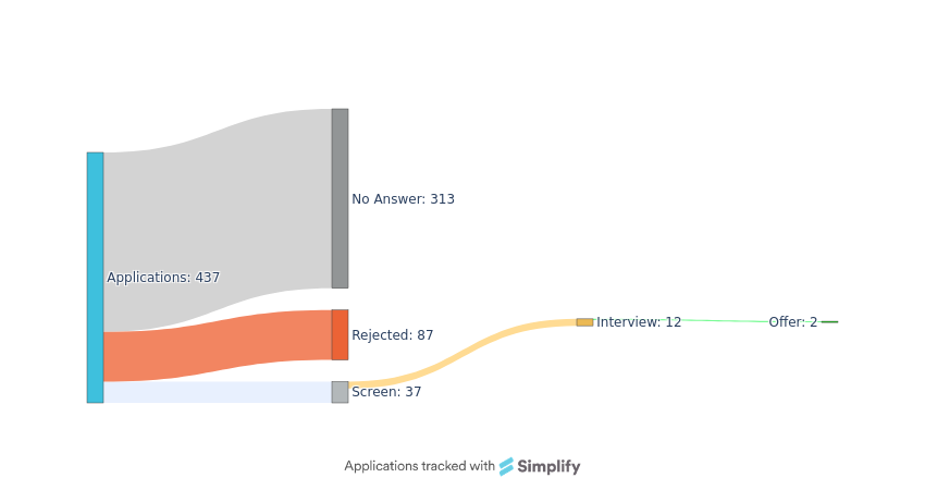 [OC] What job hunting has been like as a (lucky) 2022 graduate in tech
Submitted by lil_techa t3_z6tjec
 Minneapolis Snow Totals Last 5 Years [OC]
Submitted by lambofgod0492 t3_ynarvj
Submitted by RakAwasXxX t3_zc9rq4
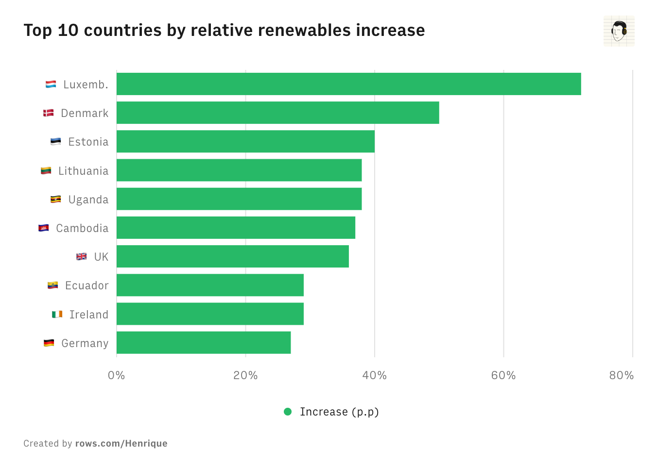 Top 10 countries by relative renewables increase 2012-2022 [OC]
Submitted by hcrx t3_zexbri
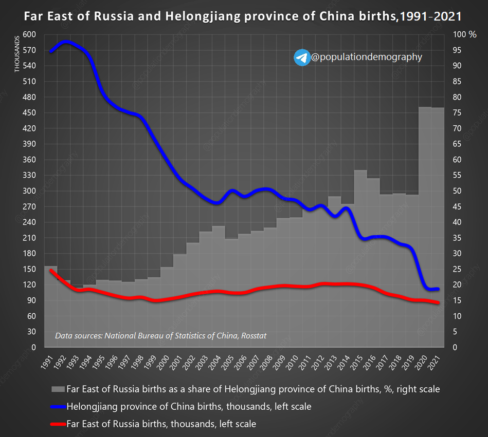 Far East of Russia (population = 8m) and Helongjiang province of China (population = 31m) births, 1991–2021 [OC]
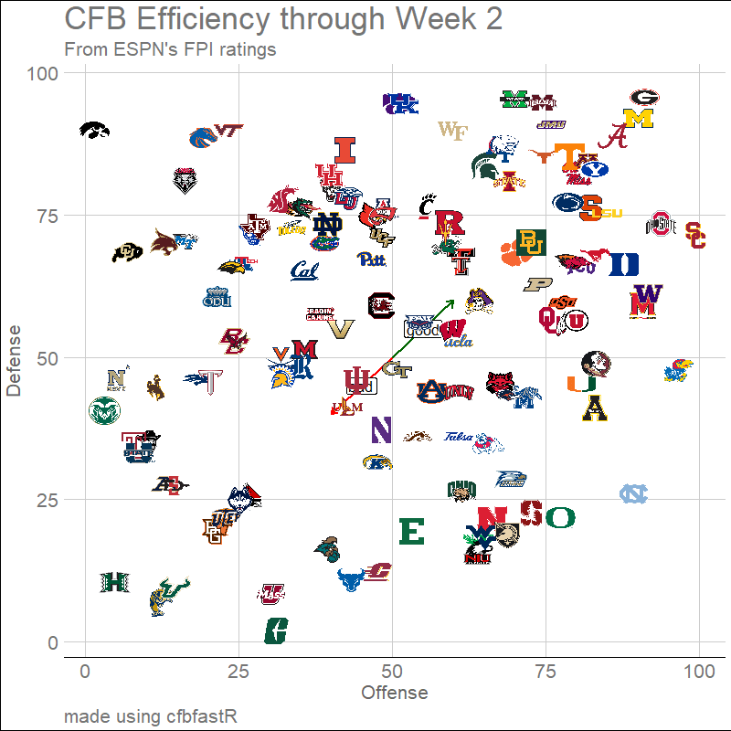 [OC] Weekly update: animated American College Football offensive and defensive efficiency through week 11. Alabama hanging out in the top right like they think they're still a top four team.
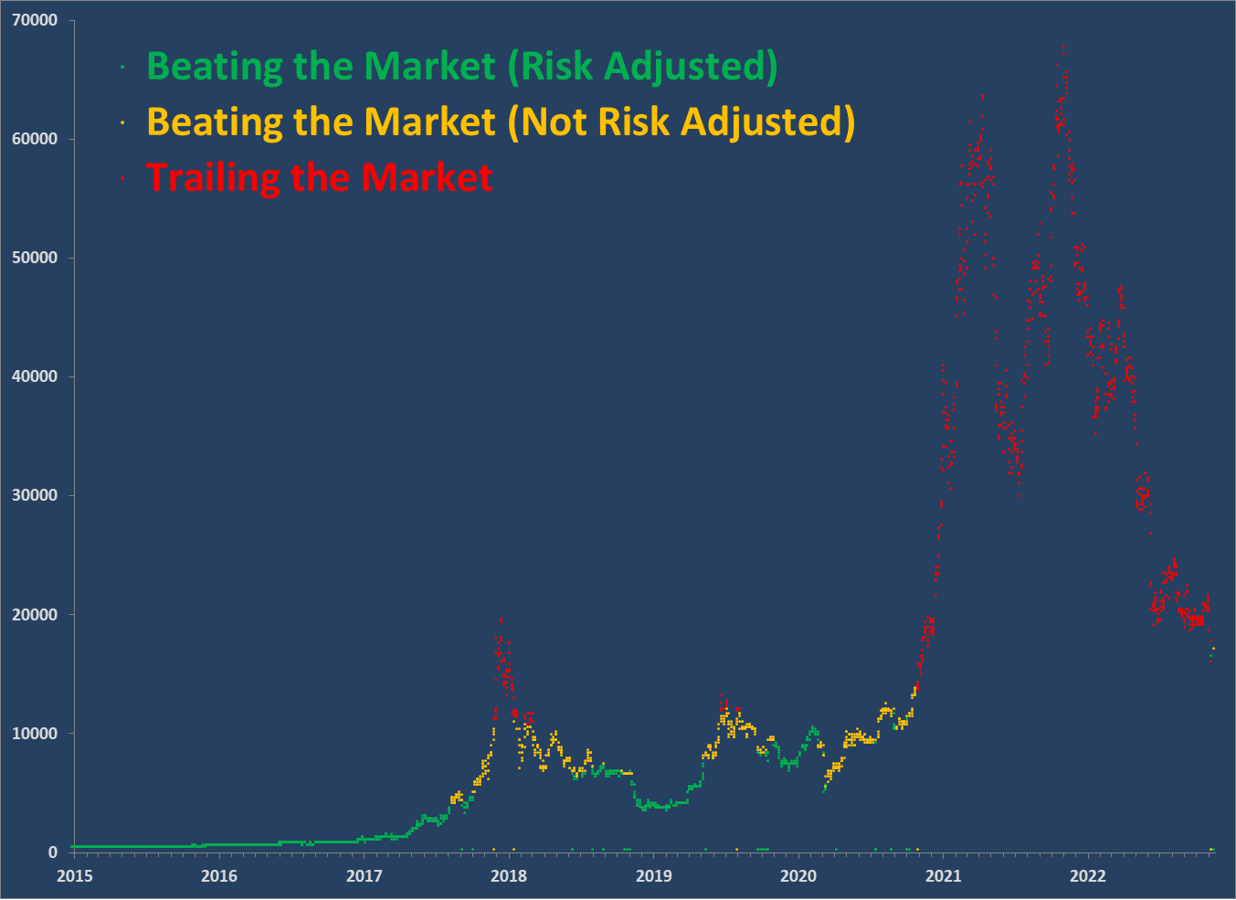 [OC] Bitcoin Return vs. S&P 500 TR assuming you bought and held until today's market close.
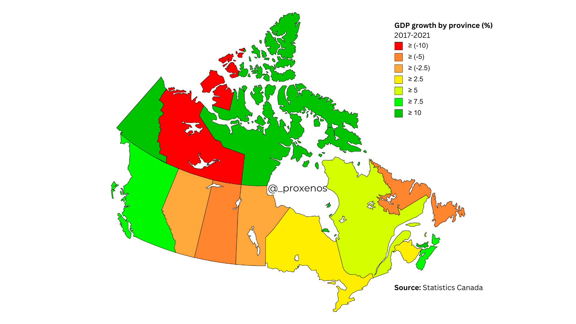 [OC] Canada GDP growth change % 2017-2021
Submitted by Kep_ t3_zawqd6
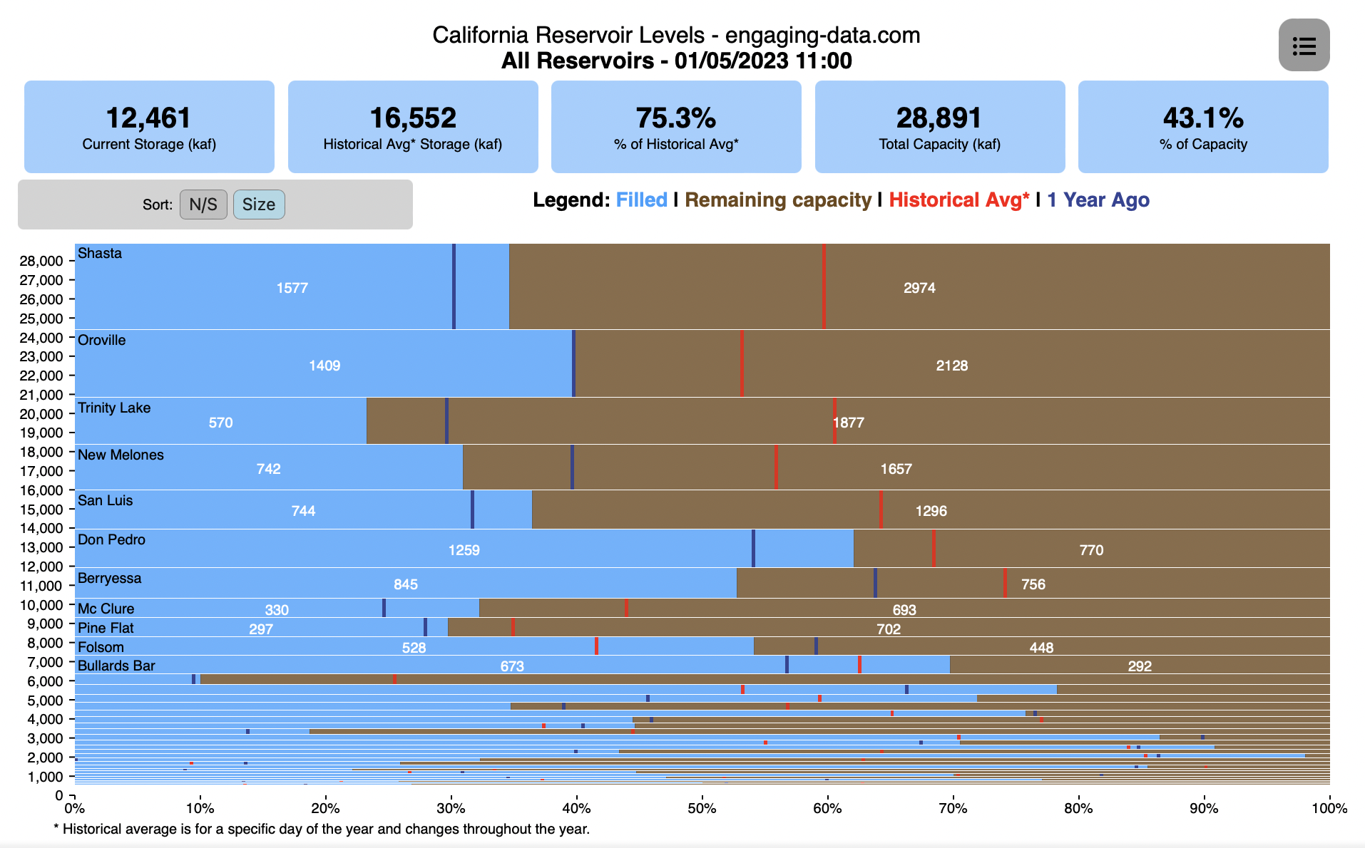 Marimekko graph of the California's Reservoir Storage Levels [OC]
Submitted by EngagingData t3_104804j