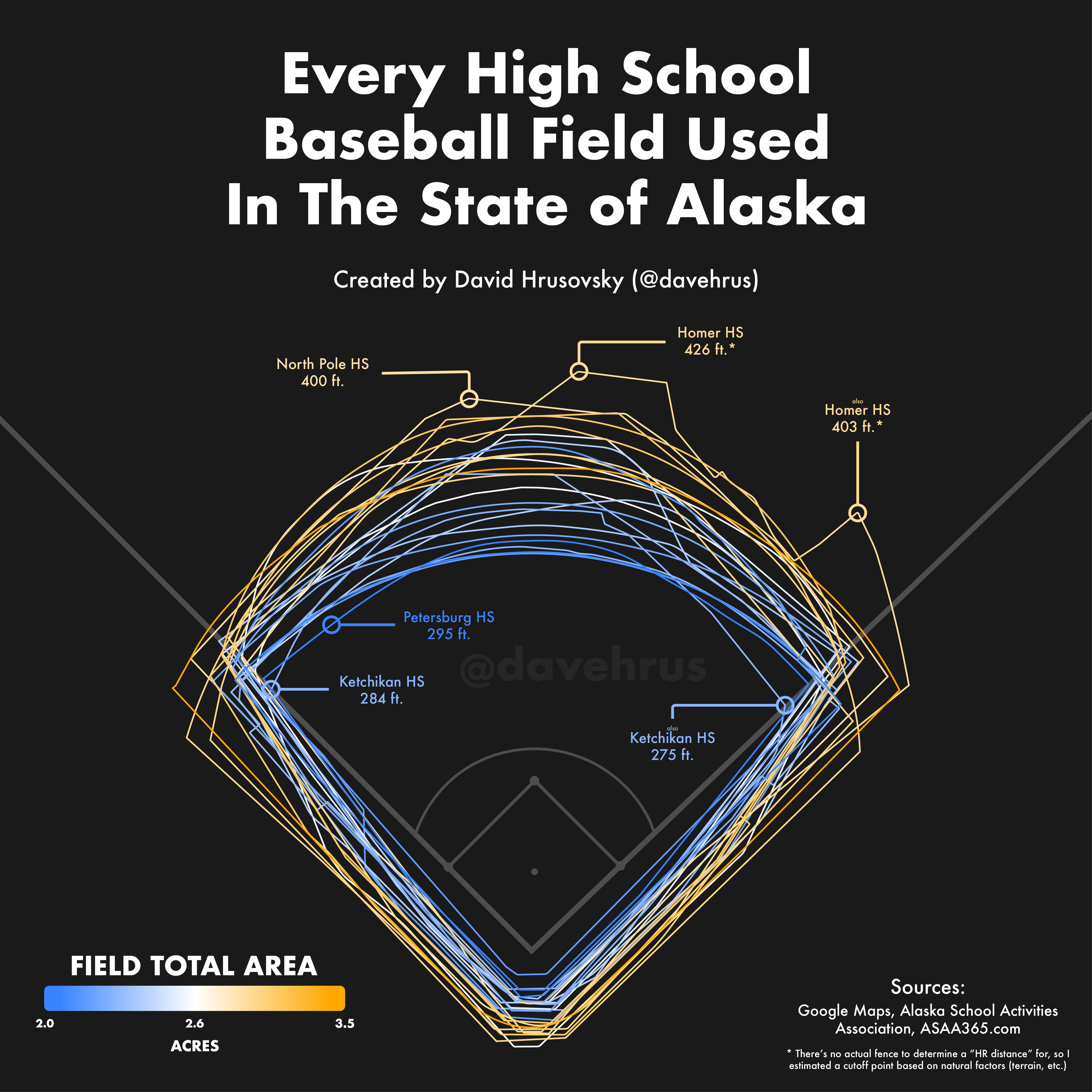
 [OC] Every High School Baseball Field Used in the State of Alaska
Submitted by dvd5671 t3_zl3wod
/f/dataisbeautiful
 A plot of the goals scored per game in the 2022 MLS season. [OC]
Submitted by sinfulducking t3_z1ocxi
Submitted by cluckingpullet t3_z01g05
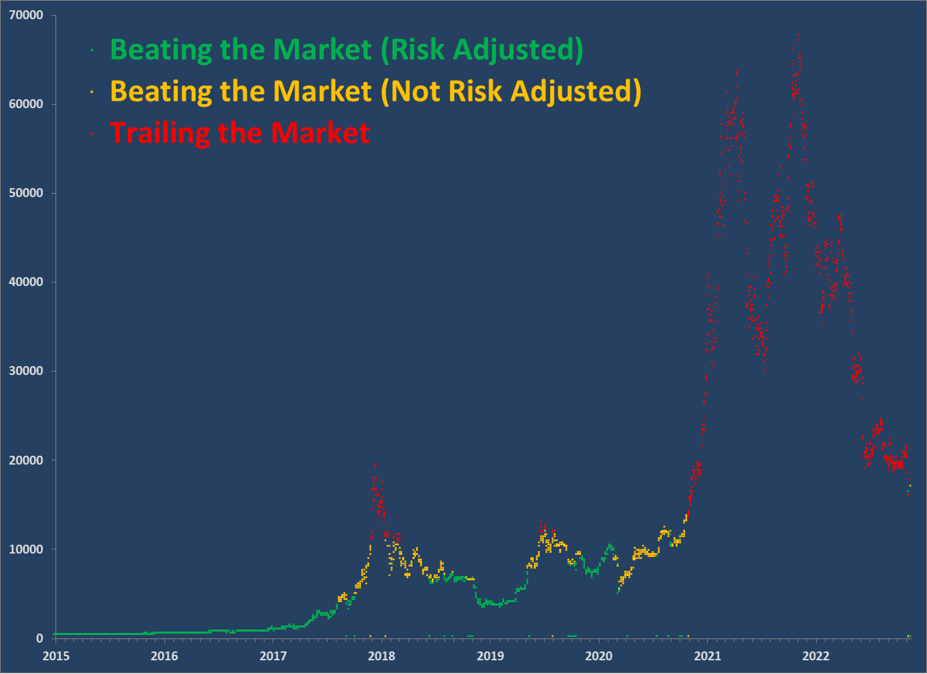 [OC] Bitcoin Return vs. S&P 500 TR assuming you bought and held until today's market close.
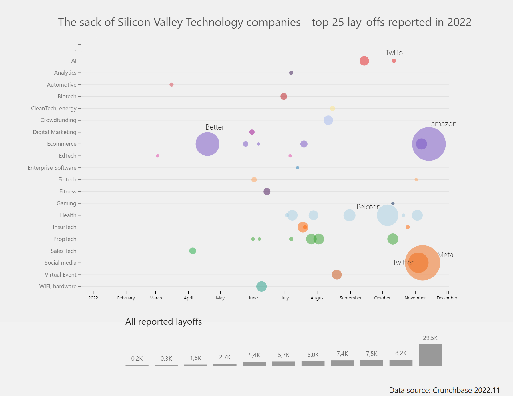 The tech sector in Silicon Valley is rebooting the system [OC]
Submitted by Chris_Schmitz t3_yvuarc
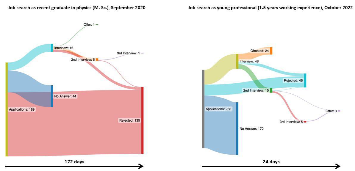 My job search history comparison. Left: Graduate during pandemic, Sept 2020. Right: Young professional recently [OC]
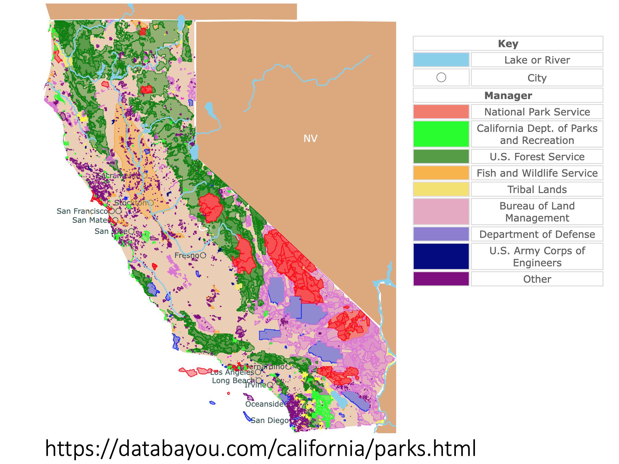 [OC] Map of California Parks
Submitted by No_Statement_3317 t3_yul4jz
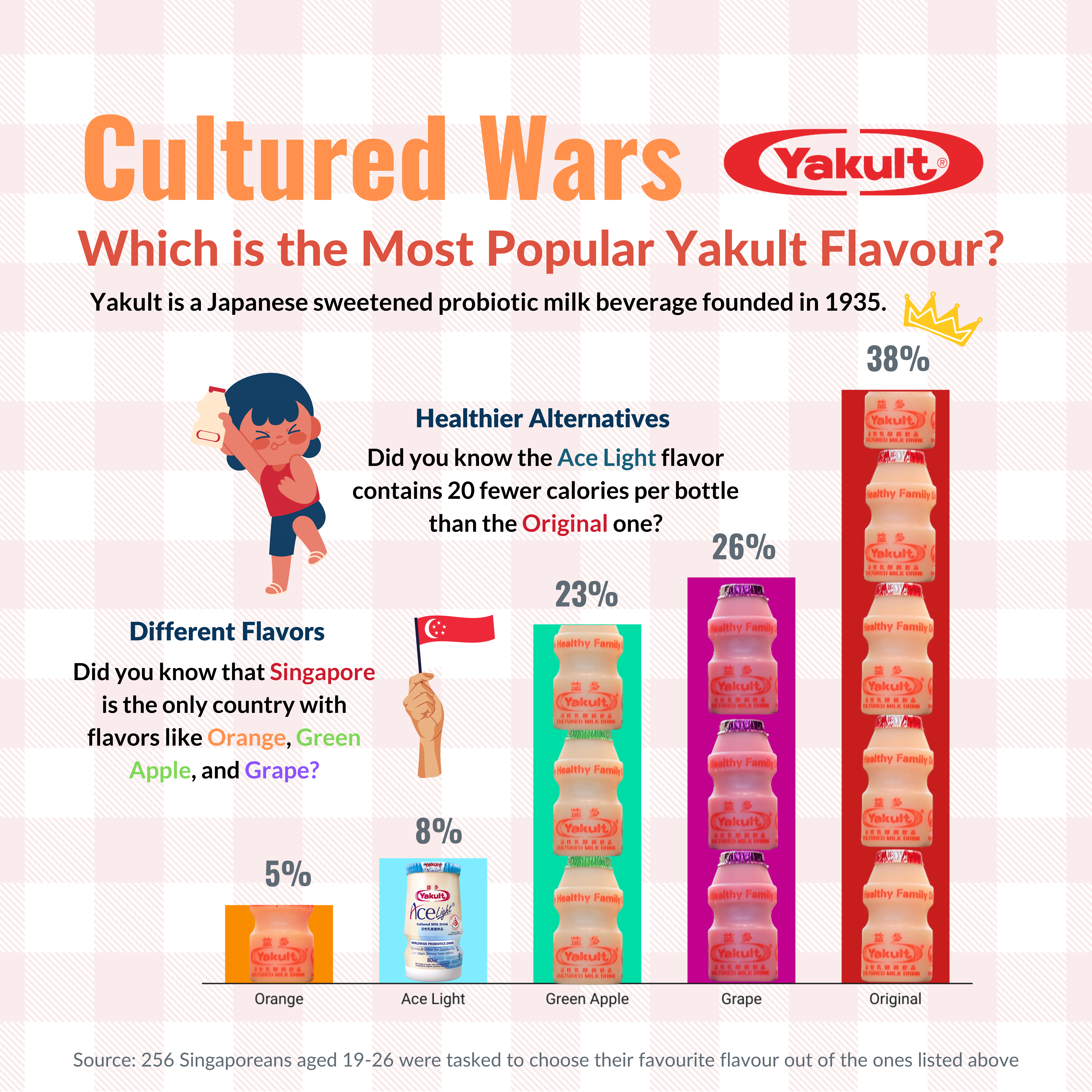 [OC] Cultured Wars: Which Yakult Flavour is the Most Popular?
Submitted by waynehihihi t3_yt6g7q
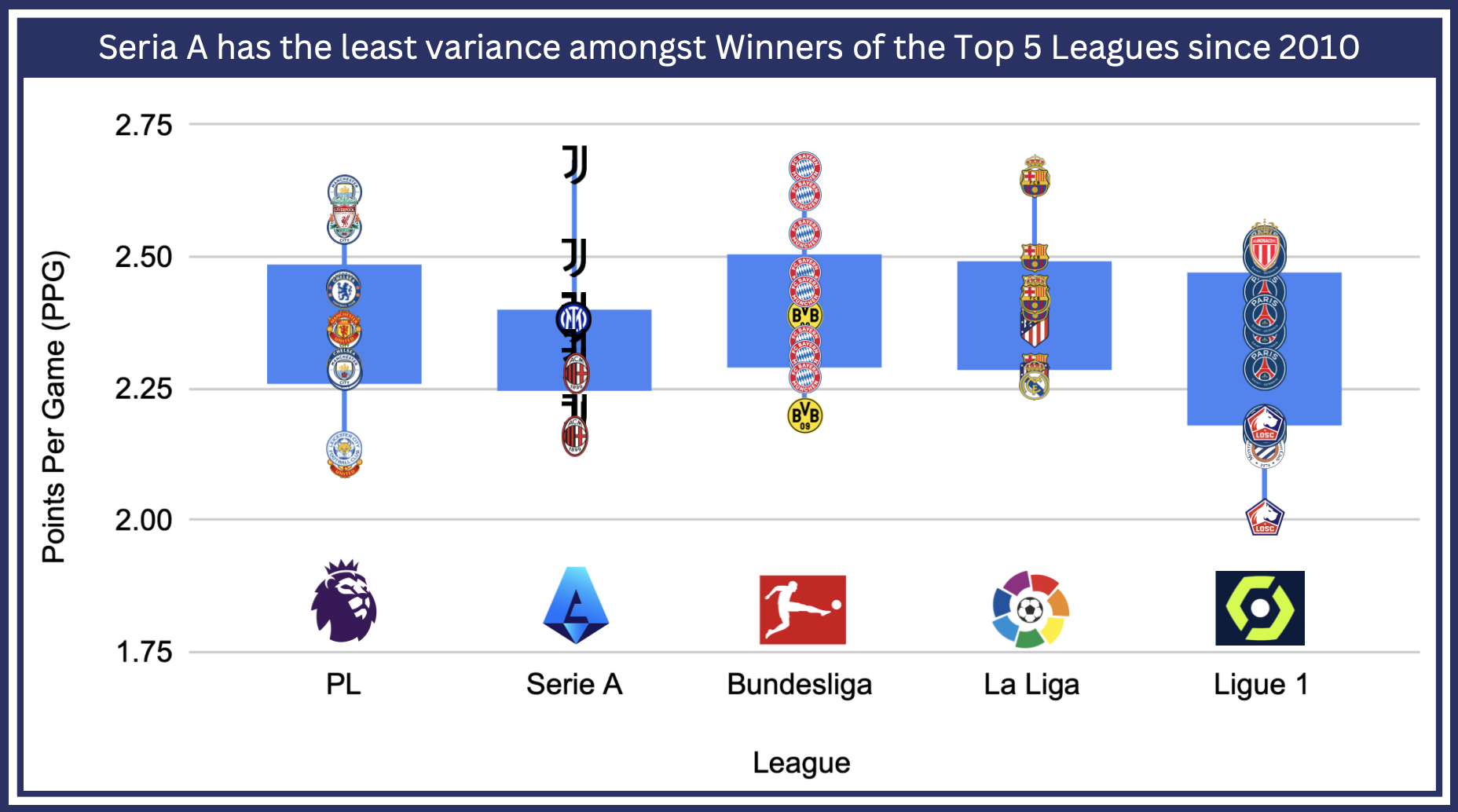 [OC] Serie A has the least variance amongst Winners of the Top 5 Leagues since 2010
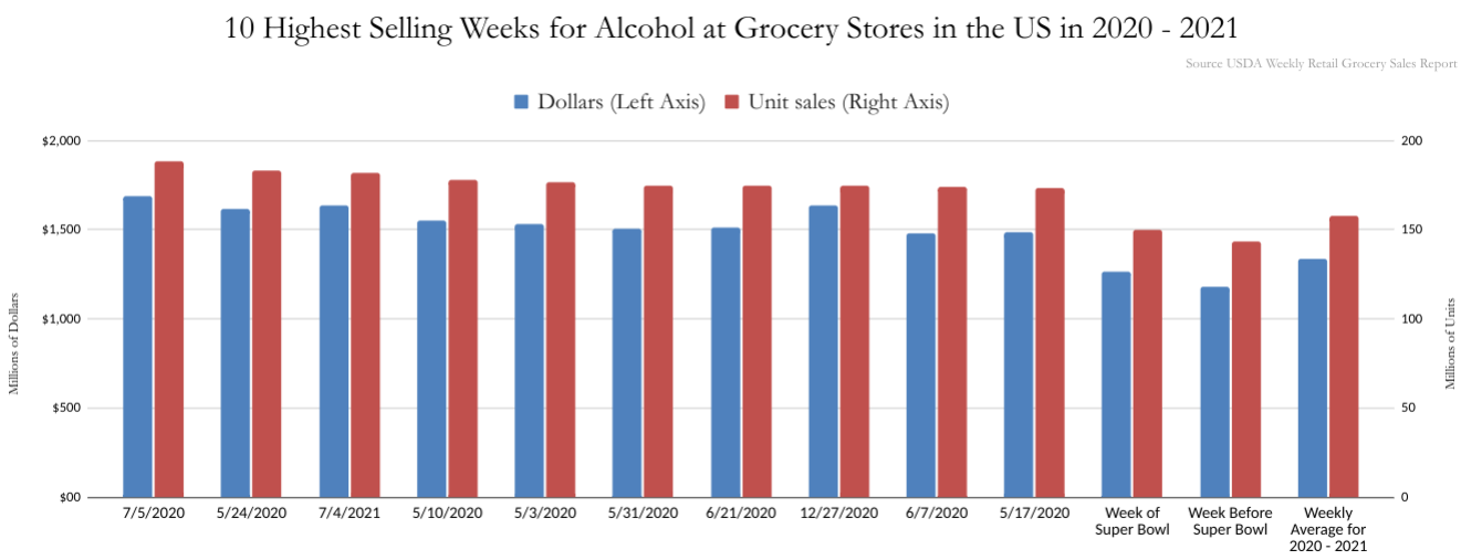 [OC] Top 10 Highest Selling Weeks for Alcohol Purchases at Grocery Stores in the US in 2020 - 2021 vs Super Bowl Purchases
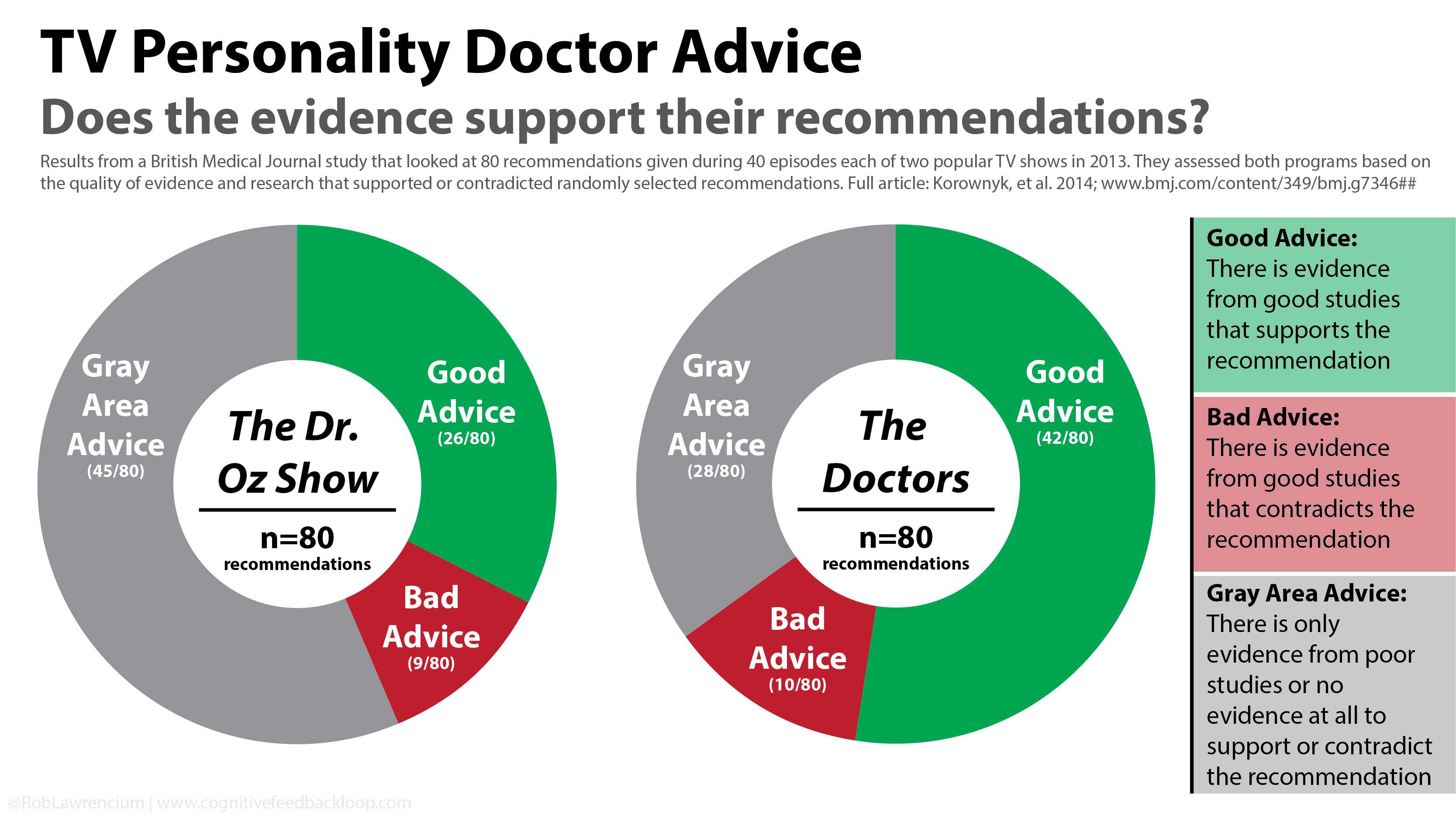 The Quality of Medical Advice from TV: Dr. Oz and The Doctors (2013) [OC]
Submitted by CognitiveFeedback t3_yjcr7a
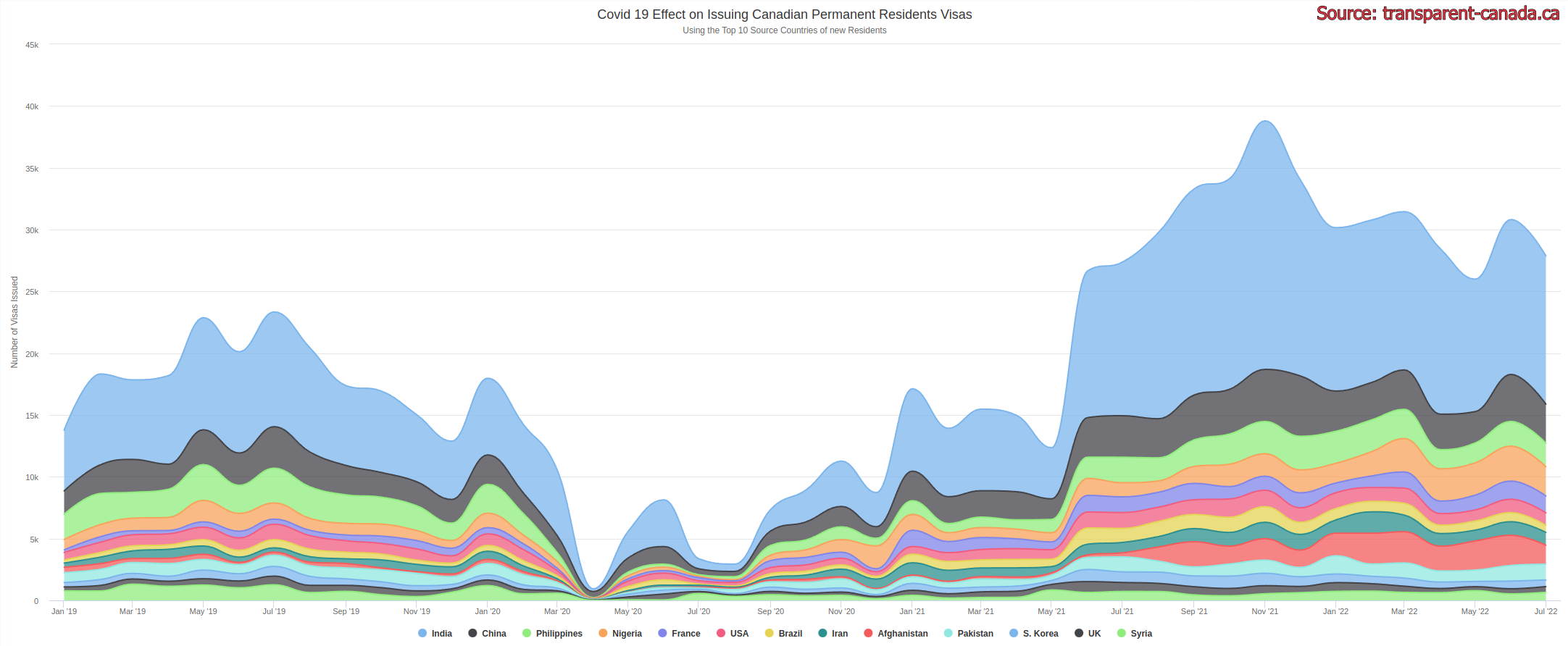 [OC] COVID 19 Effect on Issuing Canadian Permanent Residents Visas for Top 10 Source Countries
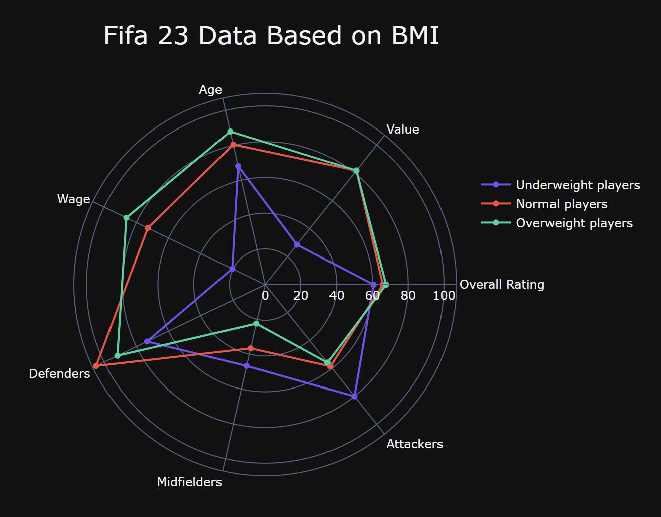 [OC] Fifa 2023 Data Based on BMI (Body mass index)
Submitted by alx_www t3_y4tdbu
Utah Highway LiDAR Scans - Utah's Department of Transportation uses state-of-the-art 3-D laser scanners to capture the surfaces and area surrounding 15,000 miles of its roads. Here's a video of "driving" driving through 20 minutes of point cloud data on Route 95 S in Utah. [OC] Source: Utah DOT.
beautifulpublicdata.comSubmitted by jonkeegan t3_yftp8m
 [OC] The value of cheese imports per head of (15+) population in 2020 by country in US$, adjusted for purchasing power
Submitted by Broad-Vacation-642 t3_yf1gme
 [OC] US infant mortality vs 3 'predictor' metrics º 2020 election
Submitted by terrykrohe t3_xxnkl0
Submitted by jeffsmith202 t3_xwqtde
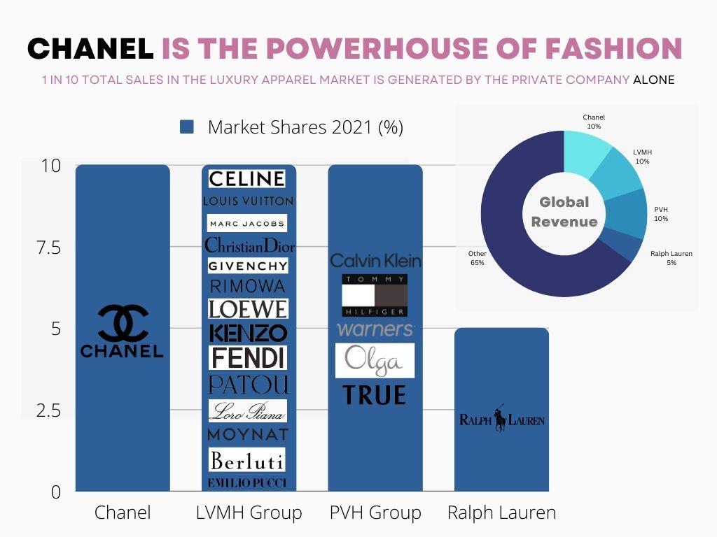 [OC] Chanel is THE powerhouse of fashion
Submitted by alison359 t3_xw7fyd
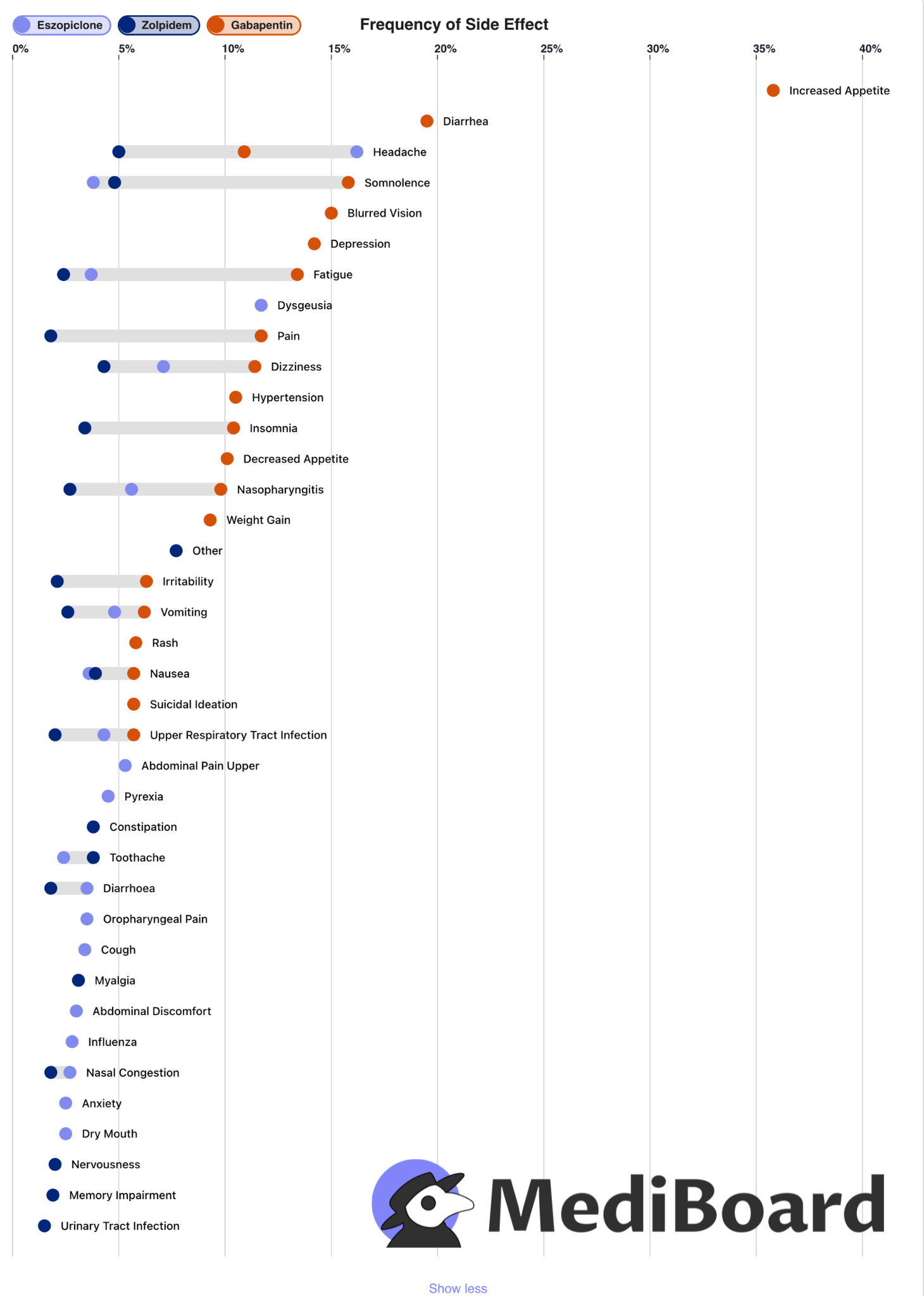 [OC] The side effects of three competing Insomnia medications visualized by frequency. Interactive version in the comments.
Submitted by Johannes8 t3_xu0bni
 How Far Are You From The Ocean? [OC]
Submitted by CharcoalCharts t3_xtz5ac
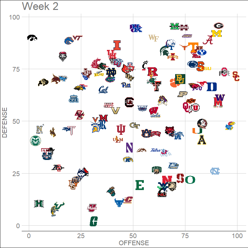 [OC] College Football FPI Efficiency Weeks 2 through 5--Kansas and TCU on a collision heading
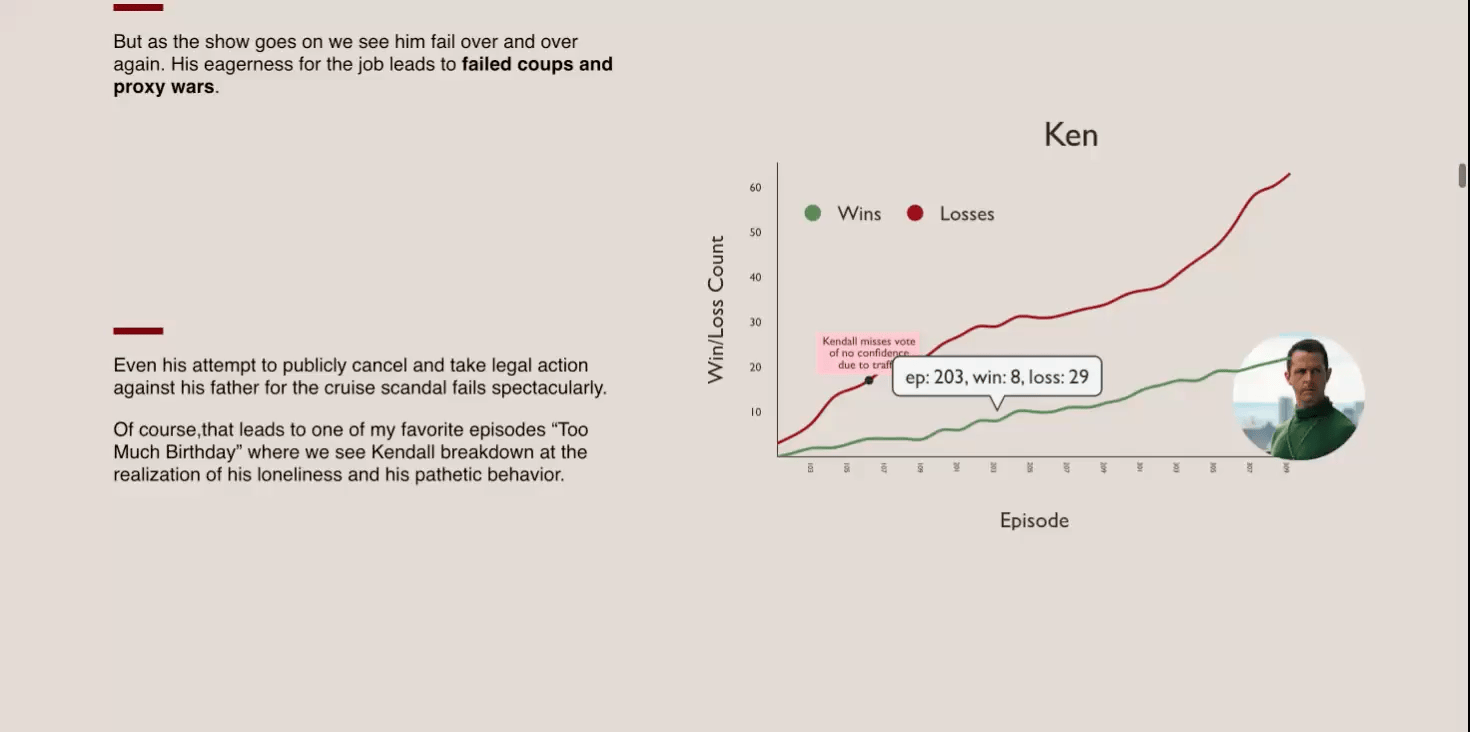 [OC] I figured out who is going to win Succession using data viz: https://riagarg.github.io/succession-viz/